
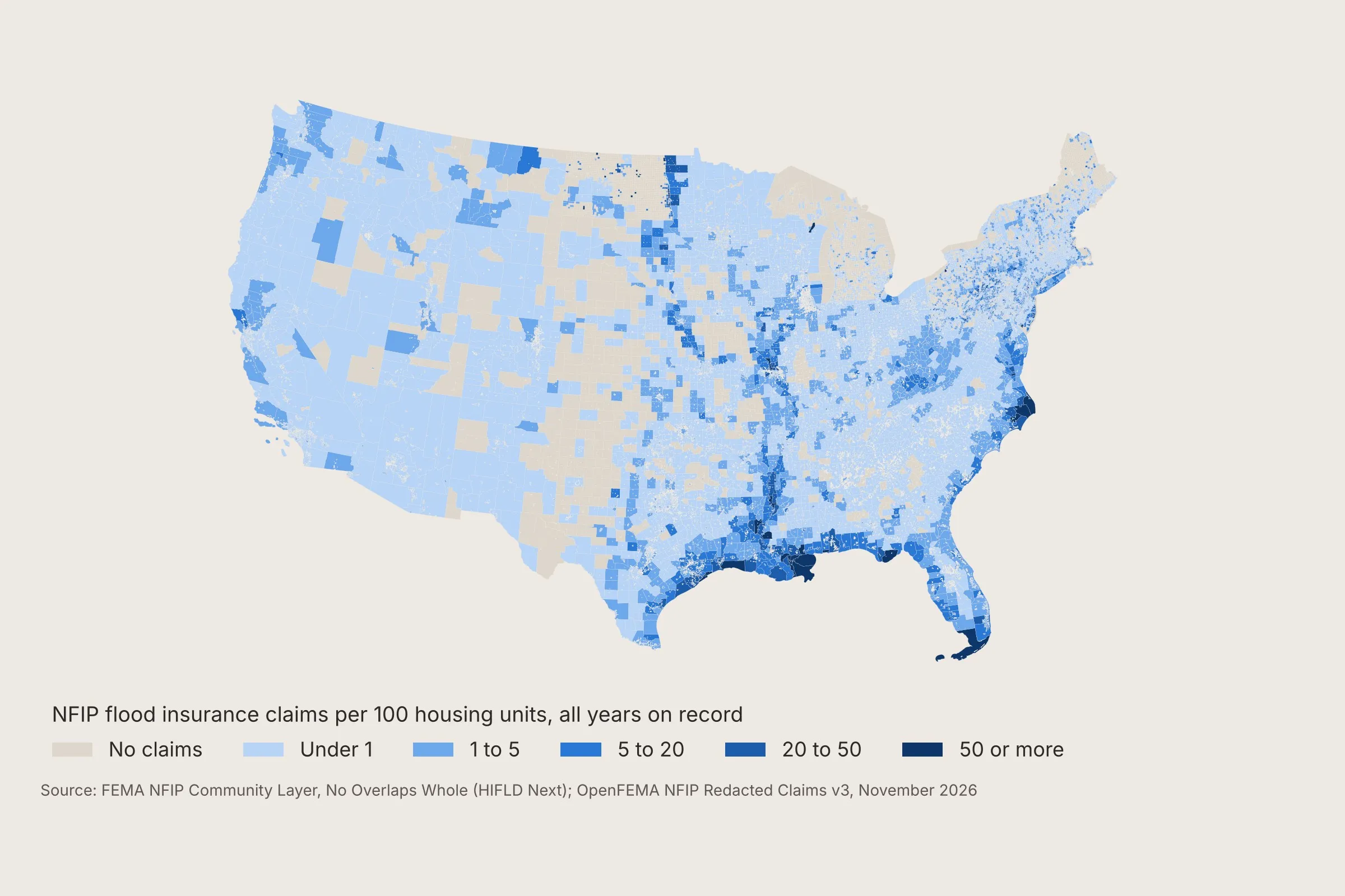
On November 9, 2026, OpenFEMA takes down all three versions of the NFIP Community Layer, and its changelog says “there will be no replacement endpoint” [1][2]. We’ve saved all three and published them on HIFLD Next with Public Environmental Data Partners, so anything built on the layer can keep working [3].
The Community Layer is how flood insurance data gets onto a map. Every National Flood Insurance Program claim and policy is filed under a six-digit community number, and FEMA built the layer “to tie Community ID numbers (CID) to jurisdiction, tribal, and special land use area boundaries” [4]. Without it, mapping NFIP data by community means matching names by hand.
It’s the first FEMA dataset on HIFLD Next, the public catalog that until now held the infrastructure layers rescued from HIFLD Open, as described in the HIFLD Next launch post.
What’s on HIFLD Next
The NFIP Community Boundaries dataset page on HIFLD Next has every version FEMA published, as GeoParquet, PMTiles, GeoPackage, shapefile and JSON, with FEMA’s metadata and a checksum for each file [3].
| Version | Polygons | Use it for |
|---|---|---|
| Comprehensive | 51,943 | The unaltered source boundaries, which overlap |
| No Overlaps Split | 37,918 | County totals, with multicounty communities split at county lines |
| No Overlaps Whole | 29,898 | Maps where communities such as Houston stay whole |
The Comprehensive GeoParquet is 172 MB and opens directly in DuckDB, QGIS or a notebook. To join it to OpenFEMA’s NFIP claims, match nfipRatedCommunityNumber in the claims to communityIdNumber in the layer [5].
DataLumos, the archive for at-risk government data at the University of Michigan’s ICPSR, has also held a copy of all three versions since February 2025 [6].
Before you switch
The layer is frozen at December 2024, and FEMA warns that “as jurisdictions may change over time, this dataset should not be considered authoritative” [4]. For which communities take part in the program today, use FEMA’s NFIP Community Status Book [7].
If a model, dashboard or study of yours calls the OpenFEMA Community Layer endpoint, point it at the HIFLD Next files before November 9. Tell us which FEMA dataset you’d want preserved next.
Sources
This article draws on FEMA’s OpenFEMA dataset metadata, changelog and dataset pages for the NFIP Community Layer, NFIP Redacted Claims v3 and the NFIP Community Status Book, HIFLD Next’s OpenFEMA collection, and DataLumos’s archived copy of FEMA’s flood insurance data.
- FEMA: OpenFEMA Data Sets metadata, NFIP Community Layer deprecation fields (read November 2, 2026)
- FEMA: OpenFEMA Changelog (October 2026)
- HIFLD Next (PEDP and Fulton Ring): NFIP Community Boundaries (2026)
- FEMA OpenFEMA: NFIP Community Layer Comprehensive v1, No Overlaps Split v1 and No Overlaps Whole v1 (data as of December 2024)
- FEMA OpenFEMA: NFIP Redacted Claims v3
- DataLumos (ICPSR): FEMA National Flood Insurance Program Data, project 218442, V3 (March 27, 2026)
- FEMA OpenFEMA: NFIP Community Status Book v1